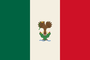
Puerto Peñasco is in Mexico today. The atlas holds 2 record volumes. The ground has flown 2 flags.
Last changed 2026-09-27 · first mapped 2026-09-23 Follow what changes.
Comes out as a sheet for the reading room — what to ask for, who holds it, and every link written out in full.
This place
Where to begin
You know your family came from Puerto Peñasco. Here is the order I would work in, cheapest and easiest first — and what to do when that runs out.
-
Work out which country your year belongs to
This is the step almost everybody skips, and it is the commonest reason a record that exists cannot be found. The ground did not move; the border did. A baptism here in one decade may sit in a different country's archive from one twenty years later.
Years Who governed Whose archive 1610–1691  Jesuit missions of Sinaloa and Sonora — Nueva Navarra, then Sonora
Archivo General de la Nación (México) · PARES · FamilySearch 1691–1786 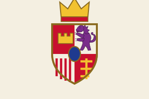 Provincias de Sonora, Ostimuri y Sinaloa
Archivo General de la Nación (México) · PARES · FamilySearch 1786–1821 Intendancy of SonoraArchivo General de la Nación (México) · PARES · FamilySearch 1821–1830 Estado de Occidente (Sonora y Sinaloa) Archivo General de la Nación (México) · FamilySearch 1830–1859 Separate states of Sonora and Sinaloa Archivo General de la Nación (México) · FamilySearch 1859–2026 Sonora and Sinaloa — civil registration Mi Registro Civil · FamilySearch · Archivo General de la Nación (México) Do this: take the year you are looking for, find its row, and note the archive. That is the one to search — not the one the village is in today.
-
The things that catch people out here
1821–1830, Estado de Occidente (Sonora y Sinaloa). The two provinces were one state from 1824, with its constitution adopted on 31 October 1825 under the name Estado de Occidente, and capitals at El Fuerte, Cosalá and Álamos. It was divided into Sonora and Sinaloa on 30 September 1830; another source dates the division to 1823-1824.
1830–1859, Separate states of Sonora and Sinaloa. Sonora's first state constitution came in 1831, with the capital moved to Hermosillo. In the Gadsden Purchase of 1853 Sonora lost more than 29,000 square miles, mostly land now in southern Arizona.
-
When you run out — and you will
Everything above is what this atlas knows. It is not everything there is. Nine places in ten on this map have never been surveyed by anybody, so a gap here is usually our silence rather than the record's absence.
Do this: write to the archive named in the era table for your year, even if we hold nothing for it. Then tell us what you found — a gap somebody has personally closed is the most useful thing a stranger can give this map.
The archives named above: Archivo General de la Nación (México) · PARES · FamilySearch · Mi Registro Civil. What each one holds and why.
How this place is on the map:
Whose archive this ground was
Puerto Peñasco sits in Sonora and Sinaloa. Which empire held it decides which archive holds its records — and for some of these years that is not the archive you would guess.
| Years | Who held it | Whose archive that means |
|---|---|---|
| 1610–1691 | Jesuit missions of Sinaloa and Sonora — Nueva Navarra, then Sonora | Archivo General de la Nación (México) · PARES · FamilySearch Jesuits began working in the coastal lowlands in the 1610s. The province was called Nueva Navarra in 1637 and renamed Sonora in 1648, and Eusebio Kino founded missions in the Pimería Alta from 1687, starting at Cucurpe. |
| 1691–1786 | Provincias de Sonora, Ostimuri y Sinaloa | Archivo General de la Nación (México) · PARES · FamilySearch Sonora and Sinaloa were joined as one province in 1691, a union that lasted until 1823. The Yaqui and Mayo uprisings came in 1740-1742 and the Jesuits were expelled in 1767, ending the mission system. |
| 1786–1821 | Intendancy of Sonora | Archivo General de la Nación (México) · PARES · FamilySearch Sonora is on the list of intendancies created in 1786. |
| 1821–1830 | Estado de Occidente (Sonora y Sinaloa) | Archivo General de la Nación (México) · FamilySearch The two provinces were one state from 1824, with its constitution adopted on 31 October 1825 under the name Estado de Occidente, and capitals at El Fuerte, Cosalá and Álamos. It was divided into Sonora and Sinaloa on 30 September 1830; another source dates the division to 1823-1824. |
| 1830–1859 | Separate states of Sonora and Sinaloa | Archivo General de la Nación (México) · FamilySearch Sonora's first state constitution came in 1831, with the capital moved to Hermosillo. In the Gadsden Purchase of 1853 Sonora lost more than 29,000 square miles, mostly land now in southern Arizona. |
| 1859–2026 | Sonora and Sinaloa — civil registration | Mi Registro Civil · FamilySearch · Archivo General de la Nación (México) Civil registration dates from 28 July 1859. Yaqui resistance in Sonora led to uprisings and forced deportations between 1887 and 1908, peaking in 1904-1908. |
The volumes
Grouped by what it costs to look, most open first, which is the order worth trying them in. The film number and denomination are from FamilySearch's own catalogue. Nobody here has opened any of them. You can, though: mark the pages you have searched on any row and this browser will remember where you stopped.
- Defunciones 1989-1993 ↗ 1989–1993
- Matrimonios, defunciones 1941-1988 ↗ 1941–1988
Sources for Mexico
The national and regional archives that cover Mexico, the national archive and library from Wikidata, and the 49 services that cover every country — FamilySearch, Ancestry, MyHeritage, Geneanet, Find a Grave and the rest — are the same for every place in Mexico, so they are listed once: all the sources for Mexico.
FamilySearch collections that reach here
A collection is a claim over an area, not a book standing in this town — so these are ranked by how specifically they reach Puerto Peñasco. A free account is needed to open the images, and some are restricted to a Family History Centre.
Narrower than the country but catalogued under some other district. Listed because a collection's title is not always where its records end, and never because it covers this ground.
- Mexico, Baja California and Baja California Sur, Catholic Church Records, 1750-1984 ↗ 1750–1984 62,346 records covers Baja California, Mexico 203 km
- Mexico, Baja California and Baja California Sur, Civil Registration, 1860-2004 ↗ 1860–2004 39,552 records covers Baja California, Mexico 203 km
- Mexico, Sonora, Civil Registration, 1861-1995 ↗ 1861–1995 796,611 records covers Sonora, Mexico 353 km
…and 57 more: every FamilySearch collection for Mexico, on the country page.
See who held Puerto Peñasco between 1800 and 1920 →
The jurisdiction answer — which empire held this ground, and therefore
whose archive — could only be got at from the map until now. This opens it there, on
1863; drag the year from any point between 1610 and
2026.
See Puerto Peñasco on the map →
Everything in Mexico · All 57354 places · Correct something on this page