Karas Region in Karas Region, Namibia. 0 record volumes and who holds them.
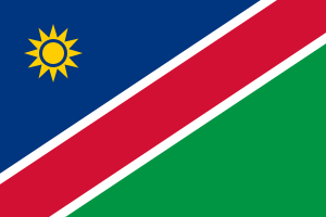
Karas Region is in Namibia today. The atlas holds no record volumes for it yet, which is a gap in the atlas and not a finding about the records. The ground has flown 2 flags.
Nothing here has changed since this page began being watched on 2026-09-23. Follow what changes.
Comes out as a sheet for the reading room — what to ask for, who holds it, and every link written out in full.
This is a region, not a town — the marker sits at its centre, not at a building. Records filed at this level are usually held for the whole region.
This place
Where to begin
You know your family came from Karas Region. Here is the order I would work in, cheapest and easiest first — and what to do when that runs out.
-
Work out which country your year belongs to
This is the step almost everybody skips, and it is the commonest reason a record that exists cannot be found. The ground did not move; the border did. A baptism here in one decade may sit in a different country's archive from one twenty years later.
Years Who governed Whose archive 1800–1860 Nama and Oorlam captaincies no archive holds this yet 1860–1884 Nama captaincies - Rhenish Mission stations no archive holds this yet 1884–1915  German South West Africa
no archive holds this yet 1915–1990  South African occupation and League of Nations mandate (South West Africa)
FamilySearch 1990–2026 Namibia - Karas and Hardap regions Gazettes.Africa · FamilySearch Do this: take the year you are looking for, find its row, and note the archive. That is the one to search — not the one the village is in today.
-
When you run out — and you will
Everything above is what this atlas knows. It is not everything there is. Nine places in ten on this map have never been surveyed by anybody, so a gap here is usually our silence rather than the record's absence.
Do this: write to the archive named in the era table for your year, even if we hold nothing for it. Then tell us what you found — a gap somebody has personally closed is the most useful thing a stranger can give this map.
The archives named above: FamilySearch · Gazettes.Africa. What each one holds and why.
How this place is on the map: listed from GeoNames as an administrative area so that a name can be found. No registers have been walked here.
Whose archive this ground was
Karas Region sits in Southern Namibia - Great Namaqualand and Hardap. Which empire held it decides which archive holds its records — and for some of these years that is not the archive you would guess.
| Years | Who held it | Whose archive that means |
|---|---|---|
| 1800–1860 | Nama and Oorlam captaincies | no registers survive Before registers. A Nama captain, Hendrik Tseib of the Kharoǃoan, found the spring at Keetmanshoop in 1808, and the Kharoǃoan clan settled there permanently in February 1850. In the 19th century Oorlam groups led by Jonker Afrikaner gained control of grazing land. |
| 1860–1884 | Nama captaincies - Rhenish Mission stations | no registers survive The Rhenish Missionary Society founded a mission at Keetmanshoop in 1860; its first missionary, Johann Georg Schröder, arrived on 14 April 1866, which is marked as the town's founding date. The town is named after Johann Keetman of the Society. |
| 1884–1915 | German South West Africa | no registers survive Germany claimed the territory in 1884 after Adolf Lüderitz's purchase of Angra Pequena. The Nama and Herero rose in 1904, and the German genocide of both peoples is dated 1904-1907 in one account. Diamonds were found in 1908. German documents that survived the First World War were later incorporated into the National Archives of Namibia in Windhoek. |
| 1915–1990 | South African occupation and League of Nations mandate (South West Africa) | FamilySearch South Africa occupied the territory in 1915 and governed it under a League of Nations mandate from 1920; the UN General Assembly ended the mandate in 1966 but South Africa kept control. The South West Africa Archives Depot, forerunner of the National Archives, was founded in 1939. |
| 1990–2026 | Namibia - Karas and Hardap regions | Gazettes.Africa · FamilySearch Namibia became independent on 21 March 1990. The Archives Act (No. 12 of 1992) governs the National Archives, which since 2000 have been in Windhoek's Eugène Marais Street. |
No volumes recorded here yet.
Sources for Namibia
The national and regional archives that cover Namibia, the national archive and library from Wikidata, and the 49 services that cover every country — FamilySearch, Ancestry, MyHeritage, Geneanet, Find a Grave and the rest — are the same for every place in Namibia, so they are listed once: all the sources for Namibia.
FamilySearch collections that reach here
A collection is a claim over an area, not a book standing in this town — so these are ranked by how specifically they reach Karas Region. A free account is needed to open the images, and some are restricted to a Family History Centre.
Worth searching, and worth knowing it is a national index rather than a local one.
- Namibia, Dutch Reformed Church Records, 1904-2010 ↗ 1904–2010 135,761 records 587 km
See who held Karas Region between 1800 and 1920 →
The jurisdiction answer — which empire held this ground, and therefore
whose archive — could only be got at from the map until now. This opens it there, on
1863; drag the year from any point between 1800 and
2026.
Everything in Namibia · All 57354 places · Correct something on this page