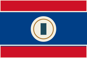
Santa Elena is in Belize today. The atlas holds no record volumes for it yet, which is a gap in the atlas and not a finding about the records. The ground has flown 3 flags.
Last changed 2026-10-07 · first mapped 2026-10-01 Follow what changes.
Comes out as a sheet for the reading room — what to ask for, who holds it, and every link written out in full.
This place
Where to begin
You know your family came from Santa Elena. Here is the order I would work in, cheapest and easiest first — and what to do when that runs out.
-
Work out which country your year belongs to
This is the step almost everybody skips, and it is the commonest reason a record that exists cannot be found. The ground did not move; the border did. A baptism here in one decade may sit in a different country's archive from one twenty years later.
Years Who governed Whose archive 1650–1786  Spanish sovereignty — British logwood-cutters (the Baymen)
no archive holds this yet 1786–1862  British Settlement in the Bay of Honduras
no archive holds this yet 1862–1964 Colony of British Hondurasno archive holds this yet 1964–1981  British Honduras — internal self-government
no archive holds this yet 1981–2026 Belize — independent from 21 September 1981no archive holds this yet Do this: take the year you are looking for, find its row, and note the archive. That is the one to search — not the one the village is in today.
-
When you run out — and you will
Everything above is what this atlas knows. It is not everything there is. Nine places in ten on this map have never been surveyed by anybody, so a gap here is usually our silence rather than the record's absence.
Do this: write to the archive named in the era table for your year, even if we hold nothing for it. Then tell us what you found — a gap somebody has personally closed is the most useful thing a stranger can give this map.
How this place is on the map:
Whose archive this ground was
Santa Elena sits in Belize (British Honduras). Which empire held it decides which archive holds its records — and for some of these years that is not the archive you would guess.
| Years | Who held it | Whose archive that means |
|---|---|---|
| 1650–1786 | Spanish sovereignty — British logwood-cutters (the Baymen) | no registers survive Buccaneers cut logwood from the 1650s and the first permanent British settlement dates from the late 1710s. Settlers elected magistrates from 1738 and Burnaby's Code of 1765 set their regulations. The 1763 and 1783 treaties allowed logwood cutting while Spanish sovereignty stood. |
| 1786–1862 | British Settlement in the Bay of Honduras | no registers survive The 1786 Convention of London allowed timber cutting but kept Spain's sovereignty and barred fortifications, government and plantations. The Battle of St George's Caye was fought in 1798 and the settlement afterwards extended south to the Sarstoon River. Britain recognised Mexico in 1825 and Mexico gave up its claim in 1826; the Dallas-Clarendon Treaty of 1856 and the Anglo-Guatemalan Treaty of 1859 followed, and the western boundary dates from 1859. |
| 1862–1964 | Colony of British Honduras | no registers survive The settlement was declared the colony of British Honduras in 1862 under a lieutenant governor subordinate to the governor of Jamaica, and a Crown colony constitution took effect in April 1871. The northern boundary with Mexico along the Rio Hondo was agreed in 1893 and finalised in 1897. |
| 1964–1981 | British Honduras — internal self-government | no registers survive Internal self-government began in January 1964 and the colony's name changed to Belize in June 1973. Guatemala's claim to the territory continued throughout. |
| 1981–2026 | Belize — independent from 21 September 1981 | no registers survive Full independence came on 21 September 1981 under the Belize Act 1981 without agreement from Guatemala, which recognised Belize's independence in 1992. In December 2008 the two countries agreed to submit the territorial dispute to the International Court of Justice. |
No volumes recorded here yet.
The ground worth walking
Within 25 km — 2 places. These neighbours hold 1 catalogued volume between them.
A register belongs to a parish, not to a village. A hamlet with no church of its own was written into the book of the church it walked to — and that book is catalogued under the other place's name. This is the ground to search before concluding a record does not exist.
- Melchor de Mencos14.8 km1 volume
Correctly placed and unread. A gap here is this atlas's silence, not the record's — the registers may well exist and nobody has walked them.
Sources for Belize
The national and regional archives that cover Belize, the national archive and library from Wikidata, and the 49 services that cover every country — FamilySearch, Ancestry, MyHeritage, Geneanet, Find a Grave and the rest — are the same for every place in Belize, so they are listed once: all the sources for Belize.
FamilySearch collections that reach here
A collection is a claim over an area, not a book standing in this town — so these are ranked by how specifically they reach Santa Elena. A free account is needed to open the images, and some are restricted to a Family History Centre.
Narrower than the country but catalogued under some other district. Listed because a collection's title is not always where its records end, and never because it covers this ground.
- Belize, Civil Registration, 1881-1951 ↗ 1881–1951 140,386 records covers British Colonial America 3050 km
Worth searching, and worth knowing it is a national index rather than a local one.
- Central America, Colonial Records, 1607-1902 ↗ 1607–1902 0 records 967 km
See who held Santa Elena between 1800 and 1920 →
The jurisdiction answer — which empire held this ground, and therefore
whose archive — could only be got at from the map until now. This opens it there, on
1863; drag the year from any point between 1650 and
2026.
Everything in Belize · All 57354 places · Correct something on this page